Avid readers and loyal fans of my blog might remember a few posts from earlier this year about the sheer amount of fires in the vicinity. Lots of dark and frightening smoke columns. I thought it would be nice to get some sense of the location of where these fires are blazing. Well, the direction is given, but the distance is hard to judge.
I was thinking back then that a few well placed and compass calibrated cameras around the city could compose a fire locating system, but it would depend on some government infrastructure which is not the best here, to say the least. If the cameras were to all look at the same point (like a smoke column) their location and bearing would give a reasonably accurate representation of where the base of the fire is. Basically what multiple Osborne Fire Finders were, but digital.
Then it hit me: What if instead of fixed cameras we used crowd-sourced cellphone provided data? They pretty much all have GPS (and GNSS and the other stuff), a compass and cameras which would be great for aiming. I threw a bit of proof of concept thing together in Angular with Supabase, then went to town to try it out. I wanted to “locate” the town hall and a few other tall features to see if it would be accurate enough. It wasn’t.
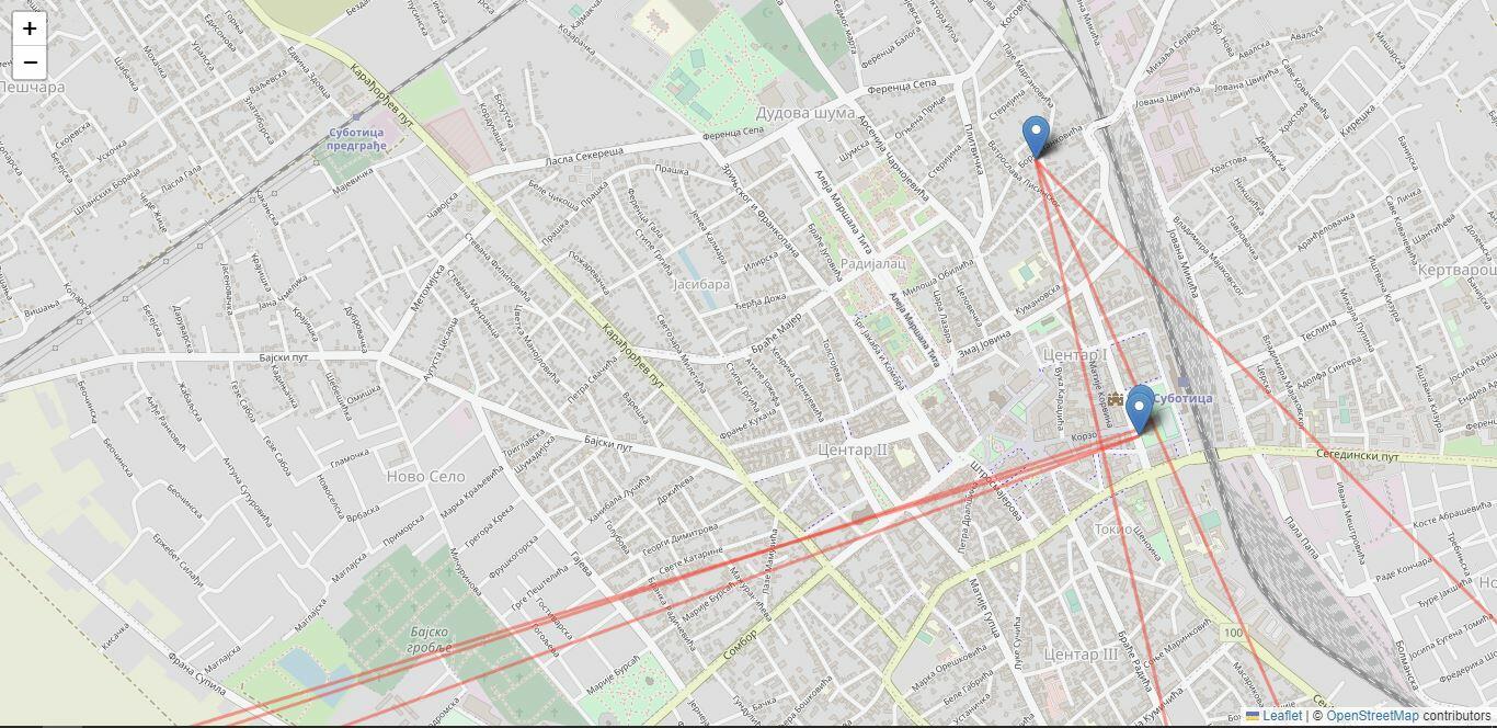
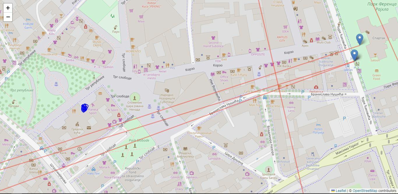
The pinpoints show the location of the phone, the red lines represent the bearing recorded. Even from a single point, three submissions gave three different directions, even after “calibration” (the waving the phone around in an 8 shape thing). Having 3 more submissions from another point shows how wildly different these measurements can be; 5-10 degrees of misalignment easily.

Remember, all these measurements were taken while pointing the camera towards the same landmark feature. The intersection point should be at the blue scribble. You can see none of them are even close.

Could choosing a further away landmark provide better results? Maybe. Could other, more premium phones have better compasses and provide better results? Probably, but overall, I don’t think there are meaningful results in these data.